by Gerardus Mercator

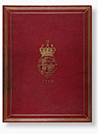
Some time around 1572 the Crown Prince of Cleves wanted to go on a European tour, but he found there were no reliable atlases. So his father asked Gerardus Mercator, the most famous map-maker of the time, to compile him one from copies of wall maps, cut and pasted to form a handy, portable atlas.After the journey the atlas can be traced to a German monastery, but it disappeared in 1797 for almost 200 years. Then, in 1967 it was bought in a Belgian second-hand bookshop by an anonymous buyer, unaware of the ragged atlas’s amazing history. Twenty years later it passed into the collection of the British Library.
The atlas, as well as being a remarkable survivor and a snapshot of a vanished world, is a volume of great beauty. Maps of Europe by both Mercator and Abraham Ortelius sit alongside exquisitely detailed city plans like that of Ancona. The iBookTreasures version allows you to magnify the tiniest details and fully appreciate why Gerardus Mercator was the greatest map-maker of his, or any other age.
This iBook contains the complete manuscript along with transcriptions and audio commentary.


